The MAAP team will present an invited talk at the ESIP July 2025 meeting titled “Cloud-Optimized LiDAR,” in the session on “Earth Data Connections: Interoperable Geospatial Tools and New Technologies with a Community-Driven Approach.” Dr. Rajat Shinde from the MAAP data team will highlight how MAAP is advancing data systems evolution by adopting cloud-native methods and open formats to make LiDAR data more accessible and actionable for the Earth science community. Using Cloud-Optimized Point Clouds (COPCs), researchers can efficiently stream, subset, and analyze massive LiDAR datasets without the need for full downloads, significantly reducing data transfer bottlenecks.
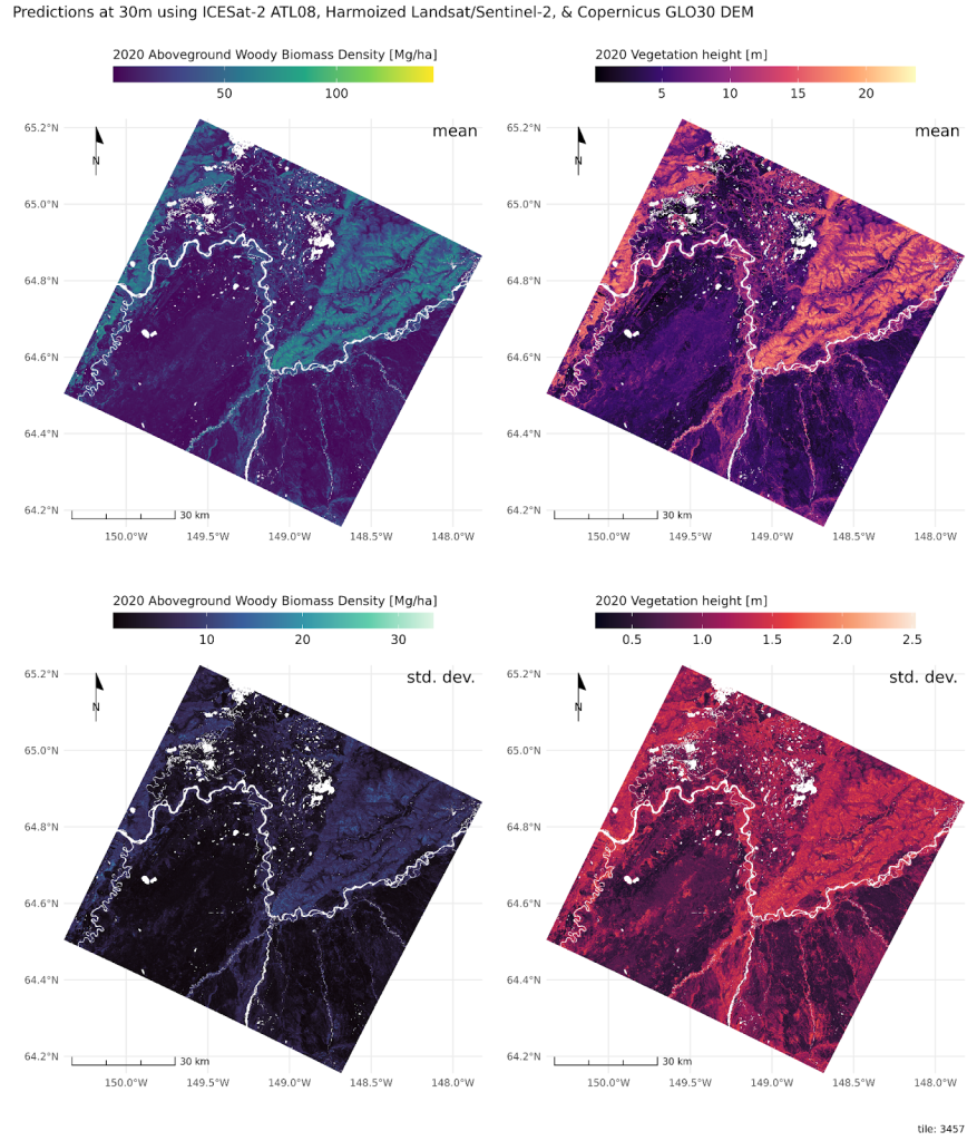
The presentation will showcase MAAP’s workflows that combine Lonboard, TiTiler, and PDAL within interactive Jupyter Notebooks to enable interactive visualization and analysis of LiDAR, raster, and vector data. These cloud-optimized workflows support reproducible, collaborative science and are already being applied to critical use cases, including Above-Ground Biomass (AGB) estimation for initiatives like GeoTREES. Attendees will also participate in a hands-on session to learn how to integrate these workflows into their own research using MAAP’s cloud-based platform.