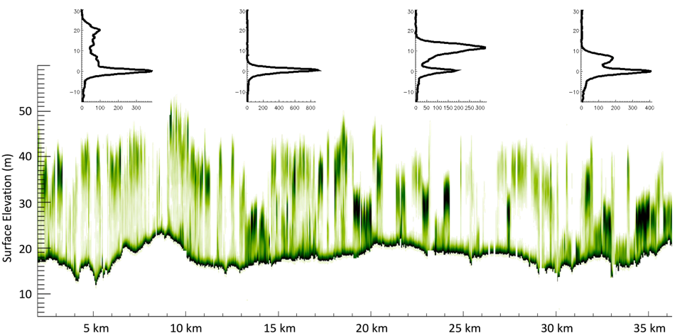
Mapping boreal forest biomass recovery rates across gradients of vegetation structure and environmental change.
The ABoVE boreal biomass mapping project has produced on MAAP a circa 2020 boreal-wide 30-m aboveground biomass map from ICESat-2 forest structure, Landsat, and other ancillary products (Ref 1). Collaborating across multiple institutions, aboveground biomass density models were created and fit to 19 million ICESat-2 observations (Ref 2), and boreal forest structure from spaceborne remote-sensing has been validated at multiple scales (Ref 3, Ref 4).
Now, the work is continuing: assessing changes in boreal biomass over time, starting with areas affected by wildfire (Ref 5), and using a suite of time-series data from Landsat and Sentinel-1 to expand to boreal-wide annual change and mapping of biomass recovery-rates after disturbance.
References:
- Ref 1, Duncanson et al. 2023: https://doi.org/10.3334/ORNLDAAC/2186
- Ref 2, Neuenschwander et al. 2024: https://doi.org/10.1016/j.srs.2024.100150
- Ref 3, Feng et al 2023: https://doi.org/10.1016/j.rse.2023.113570
- Ref 4, Neuenshwander et al. 2020: https://doi.org/10.1016/j.rse.2020.112110
- Ref 5, Feng et al 2024, DOI: 10.1109/JSTARS.2024.3400218