
News
MAAP Team to Present at ESIP July 2025 Meeting
The MAAP team will present an invited talk at the ESIP July 2025 meeting titled “Cloud-Optimized LiDAR,” in the session on “Earth Data Connections: Interoperable Geospatial Tools and New Technologies with a Community-Driven Approach.” Dr. Rajat Shinde from the MAAP data team will highlight how MAAP is advancing data systems evolution by adopting cloud-native methods…
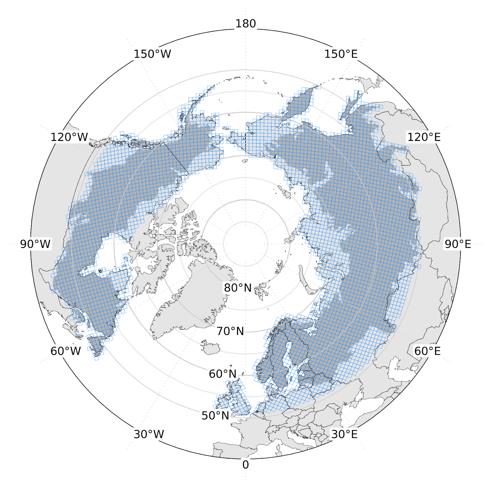
Circumpolar boreal biomass-density and vegetation-height is being transferred to the ORNL DAAC
Circumpolar boreal aboveground biomass density (AGBD) and vegetation height (v2) is being transferred to the Oak Ridge National Laboratory DAAC. The map is built on MAAP with machine-learning models combining the 2020 archive of ICESat-2 height estimates with predictors from topography and Harmonized Landsat/Sentinel-2 surface reflectance. The v2 dataset is available on the MAAP STAC.…
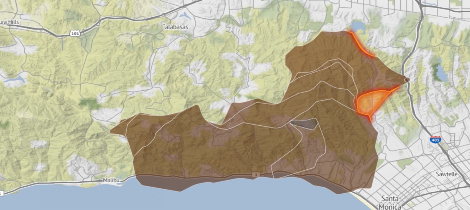
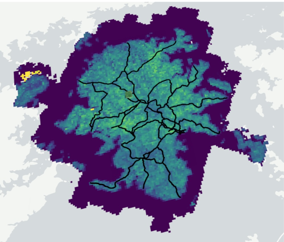
Fire Events Data Suite (FEDS) Uses MAAP to Deploy Fire-Tracking Capabilities
The Fire Events Data Suite (FEDS) uses remotely-sensed fire hotspots to generate near-real-time estimates of fire behavior. FEDS provides fire perimeters, estimates of the active fire line, and mean radiative power for the fire. FEDS data helps scientists understand how fires evolve and spread through time. FEDS tracks fire in the continental United States and…
READ MORE Fire Events Data Suite (FEDS) Uses MAAP to Deploy Fire-Tracking Capabilities

AGU 2024
The MAAP team will be at the annual AGU meeting in December 2024. Find all related talks using the AGU search tool, or see the highlights below. MAAP-Focused Talks/Posters Monday, 9 December 8:50am – 9:00amHighlights on Bringing an Interdisciplinary Collaboration of Large-Scale Science Data Processing Capabilities from Research to Missions to Analysis Platforms (Invited) Talk by…

ESIP 2024
We will be at ESIP in July 2024! Come say hi. The MAAP Team has organized a session on Cross-Platform Interoperability for Scalable Computing in Open Science Analysis and Algorithm Development. Thursday July 25, 2024 8:30am – 10:00am EDT https://2024julyesipmeeting.sched.com/event/1eVM0/mt-pilot-cross-platform-interoperability-for-scalable-computing-in-open-science-analysis-and-algorithm-development
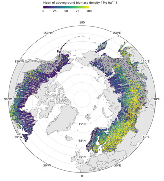
Towards global spaceborne lidar biomass: Developing and applying boreal forest biomass models for ICESat-2 laser altimetry data
Space-based laser altimetry has revolutionized our capacity to characterize terrestrial ecosystems through the direct observation of vegetation structure and the terrain beneath it. Data from NASA’s ICESat-2 mission provide the first comprehensive look at canopy structure for boreal forests from space-based lidar. The objective of this research was to create ICESat-2 aboveground biomass density (AGBD)…