
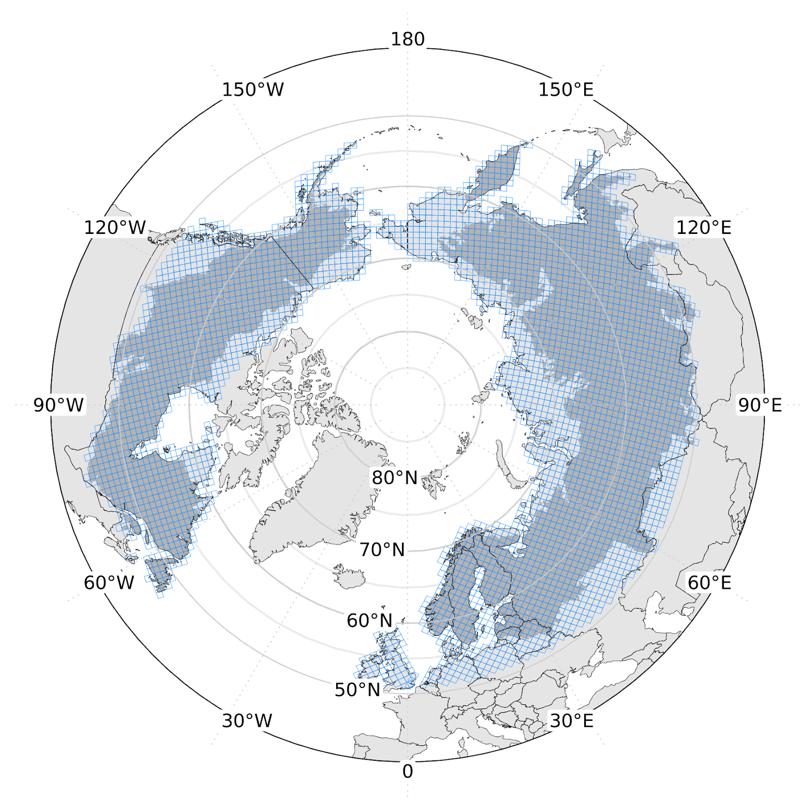
Circumpolar boreal biomass-density and vegetation-height is being transferred to the ORNL DAAC
Circumpolar boreal aboveground biomass density (AGBD) and vegetation height (v2) is being transferred to the Oak Ridge National Laboratory DAAC. The map is built on MAAP with machine-learning models combining the 2020 archive of ICESat-2 height estimates with predictors from topography and Harmonized Landsat/Sentinel-2 surface reflectance. The v2 dataset is available on the MAAP STAC.…
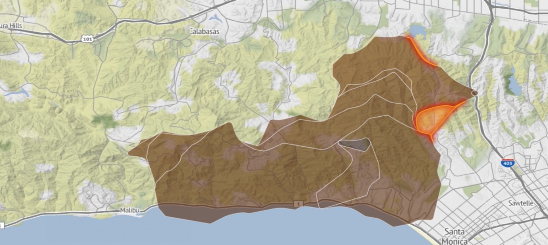
Fire Events Data Suite (FEDS) Uses MAAP to Deploy Fire-Tracking Capabilities
The Fire Events Data Suite (FEDS) uses remotely-sensed fire hotspots to generate near-real-time estimates of fire behavior. FEDS provides fire perimeters, estimates of the active fire line, and mean radiative power for the fire. FEDS data helps scientists understand how fires evolve and spread through time. FEDS tracks fire in the continental United States and…
Continue Reading >> Fire Events Data Suite (FEDS) Uses MAAP to Deploy Fire-Tracking Capabilities
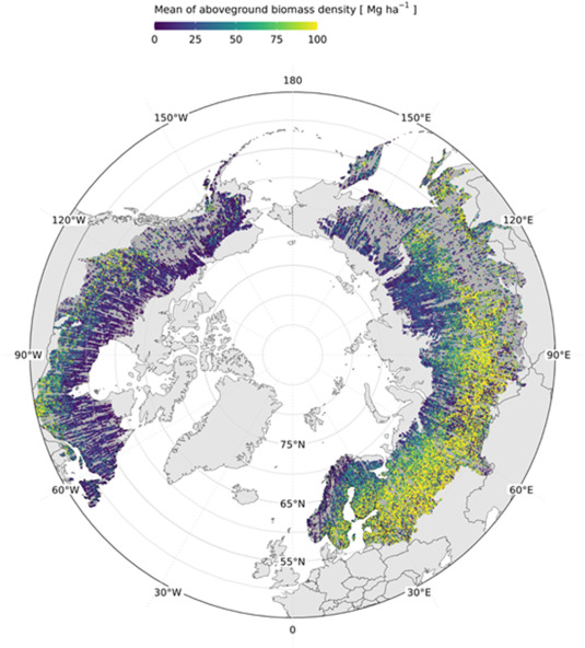
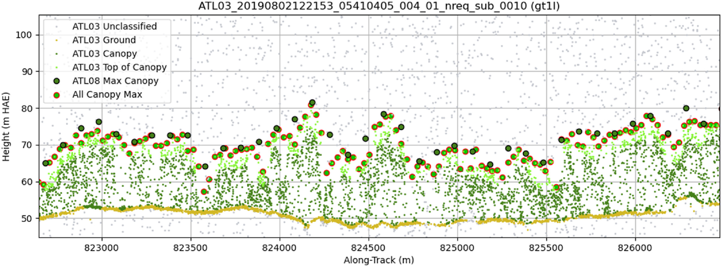
Towards global spaceborne lidar biomass: Developing and applying boreal forest biomass models for ICESat-2 laser altimetry data
Space-based laser altimetry has revolutionized our capacity to characterize terrestrial ecosystems through the direct observation of vegetation structure and the terrain beneath it. Data from NASA’s ICESat-2 mission provide the first comprehensive look at canopy structure for boreal forests from space-based lidar. The objective of this research was to create ICESat-2 aboveground biomass density (AGBD)…
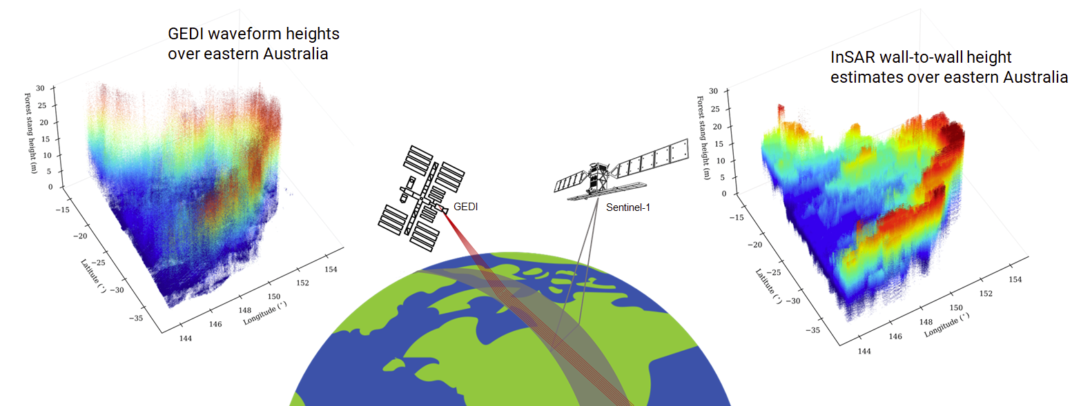
Large-Scale Canopy Height Mapping Using C-band InSAR Coherence and GEDI LiDAR Data
Dry forests and savannas have highly heterogeneous horizontal and vertical structure of woody vegetation and high temporal variability in moisture and phenology. This presents distinct challenges to SAR-based approaches to mapping canopy-height compared to tropical and temperate forests. Dense time-series of C-band (Sentinel-1A/1B) and, in future, L-band (NASA/ISRO NISAR) provide a pathway to reduce the…
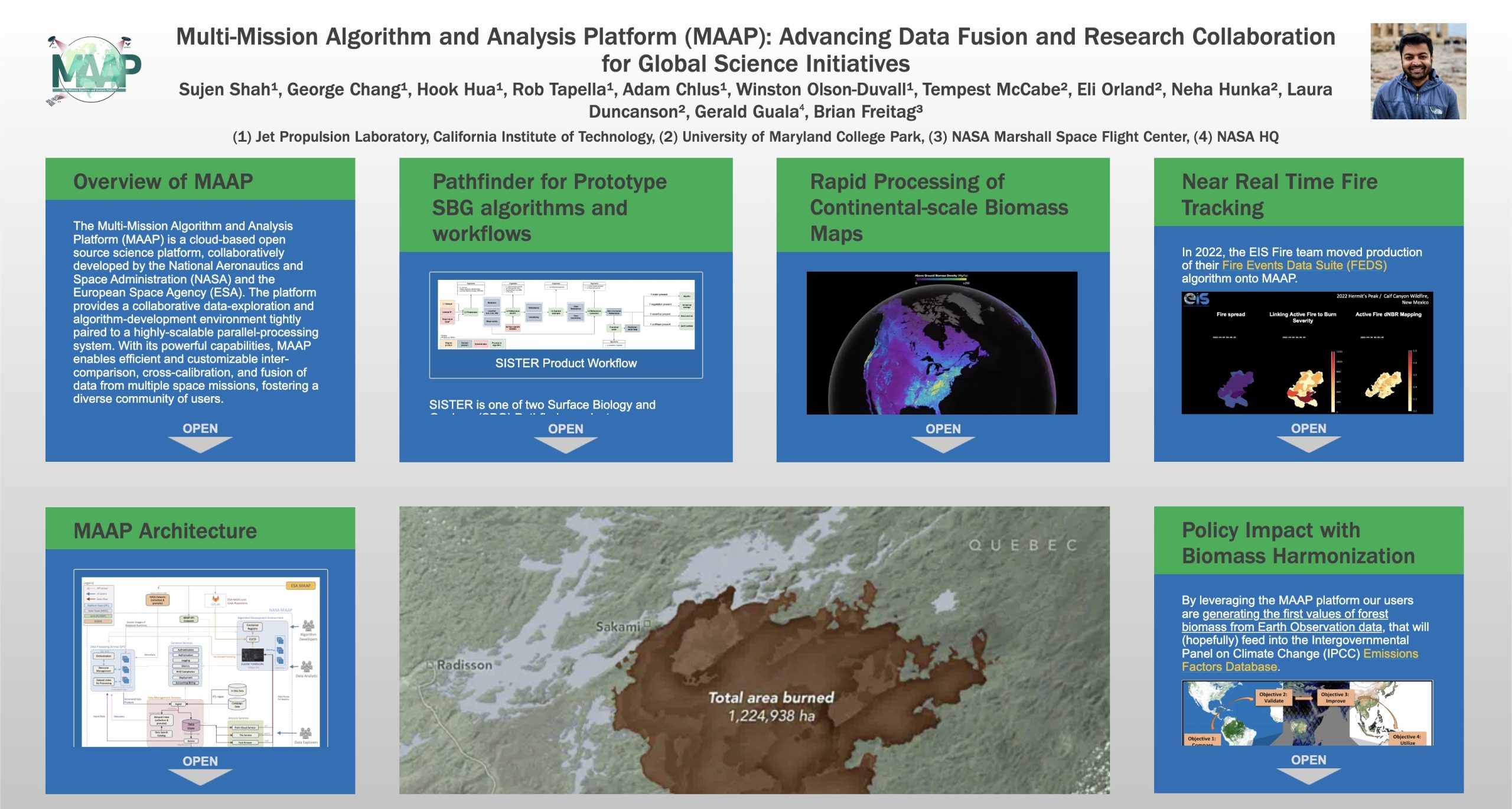
Advancing Data Fusion and Research Collaboration for Global Science Initiatives
Sujen Shah will present a poster highlighting several science applications of the MAAP Platform at AGU 2023. In this presentation, we will delve into the remarkable ways in which various teams have embraced and integrated the MAAP platform, yielding significant achievements. One such success story is the SISTER SBG Pathfinder project, which has seamlessly incorporated…
Continue Reading >> Advancing Data Fusion and Research Collaboration for Global Science Initiatives
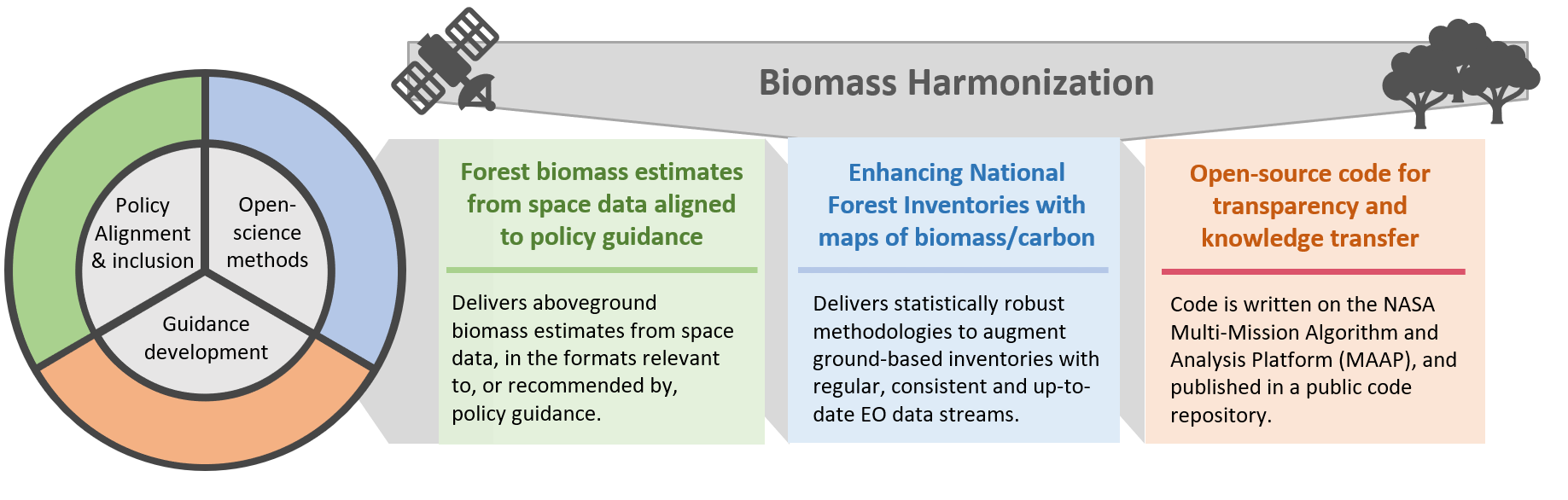
Committee of Earth Observation Satellites (CEOS) Biomass Harmonization
Biomass Harmonization is a coordinated effort of scientists to release forest-carbon estimates obtained with space data in a comparable manner. This helps identify underlying assumptions, definitions and uncertainty-estimation frameworks (Ref 1). By collaborating with scientists and policy-makers in various countries, this effort also aims to align the carbon estimates with policy guidelines, which will ease…
Continue Reading >> Committee of Earth Observation Satellites (CEOS) Biomass Harmonization
Arctic-Boreal Vulnerability Experiment (ABoVE)
Mapping boreal forest biomass recovery rates across gradients of vegetation structure and environmental change. The ABoVE boreal biomass mapping project has produced on MAAP a circa 2020 boreal-wide 30-m aboveground biomass map from ICESat-2 forest structure, Landsat, and other ancillary products (Ref 1). Collaborating across multiple institutions, aboveground biomass density models were created and fit…
Continue Reading >> Arctic-Boreal Vulnerability Experiment (ABoVE)